Understanding Tāmaki Makaurau: Māori stories behind Auckland's landscape
Why Auckland’s Māori name matters
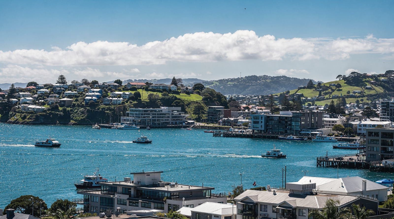
Long before it was Auckland, this isthmus between the Waitematā and Manukau harbours was — and still is — Tāmaki Makaurau. The name is usually translated as “Tāmaki desired by many” or “Tāmaki of a hundred lovers,” a reference to how fiercely the region’s iwi (tribes) contested it over centuries. That’s not poetic flourish; it’s a fair description of the place. The isthmus sits on two harbours, rich volcanic soil, abundant fishing grounds and a narrow land bridge between the Pacific and Tasman coasts, which made it one of the most strategically and agriculturally valuable pieces of land in the country. Understanding that single name tells you most of what you need to know about why Auckland exists where it does, and why it changed hands between iwi so many times before European settlement.
Who holds mana whenua over the isthmus
Ngāti Whātua is the iwi most closely associated with mana whenua — customary authority and connection — over the central Auckland isthmus today, and their presence and settlements at places like Ōrākei (near Bastion Point) are well documented. The wider history of Tāmaki Makaurau involves multiple iwi and hapū (sub-tribes) across different eras, since control of the isthmus shifted repeatedly through conflict, alliance and settlement over hundreds of years before 1840. This is genuinely complex history, and it’s worth being upfront that a short blog post like this one can only give you the broad shape of it, not the specific details of which hapū held which particular site at which particular time — that level of detail is exactly the kind of knowledge that belongs to iwi themselves and to properly researched cultural and historical sources, not a generalised tourism article.
The maunga: mountains as ancestors
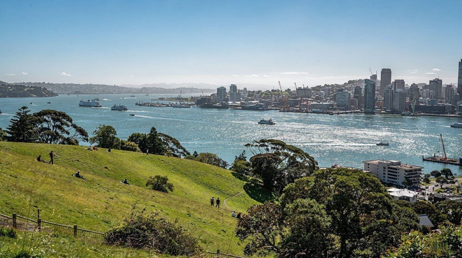
Auckland’s volcanic field is one of the city’s defining features — around 50 volcanic cones and craters scattered across the isthmus, several of them, like Maungawhau (Mount Eden) and Maungakiekie (One Tree Hill), rising directly out of suburban streets. In Māori tradition, these maunga are not simply geographic features or scenic lookouts. They’re widely understood and described as tūpuna maunga — ancestor mountains — carrying genealogical and spiritual significance, and many were also the sites of major pā (fortified settlements), with terracing still visible on their slopes today.
That dual status, sacred ancestor and defensible stronghold, is part of why the cones matter so much to the iwi of Tāmaki Makaurau, and why they’re treated with a level of respect and tapu (sacredness or restriction) that a casual visitor might not immediately register. Our volcanic cones of Auckland guide covers the cones from a visiting-and-hiking angle, but it’s worth carrying this context with you when you’re standing on one.
Rūaumoko and the volcanic landscape
Māori cosmology offers a broader explanatory frame for the volcanic activity that shaped this entire region: Rūaumoko, in widely published tradition, is associated with earthquakes and volcanic activity, generally described as the youngest child of Papatūānuku (the earth) and Ranginui (the sky), still moving within the earth. This is the kind of general cosmological context that appears consistently across published Māori history and museum interpretation, and it offers a genuinely different way of understanding Auckland’s volcanic field than a purely geological one — not competing explanations so much as two different kinds of knowledge sitting side by side.
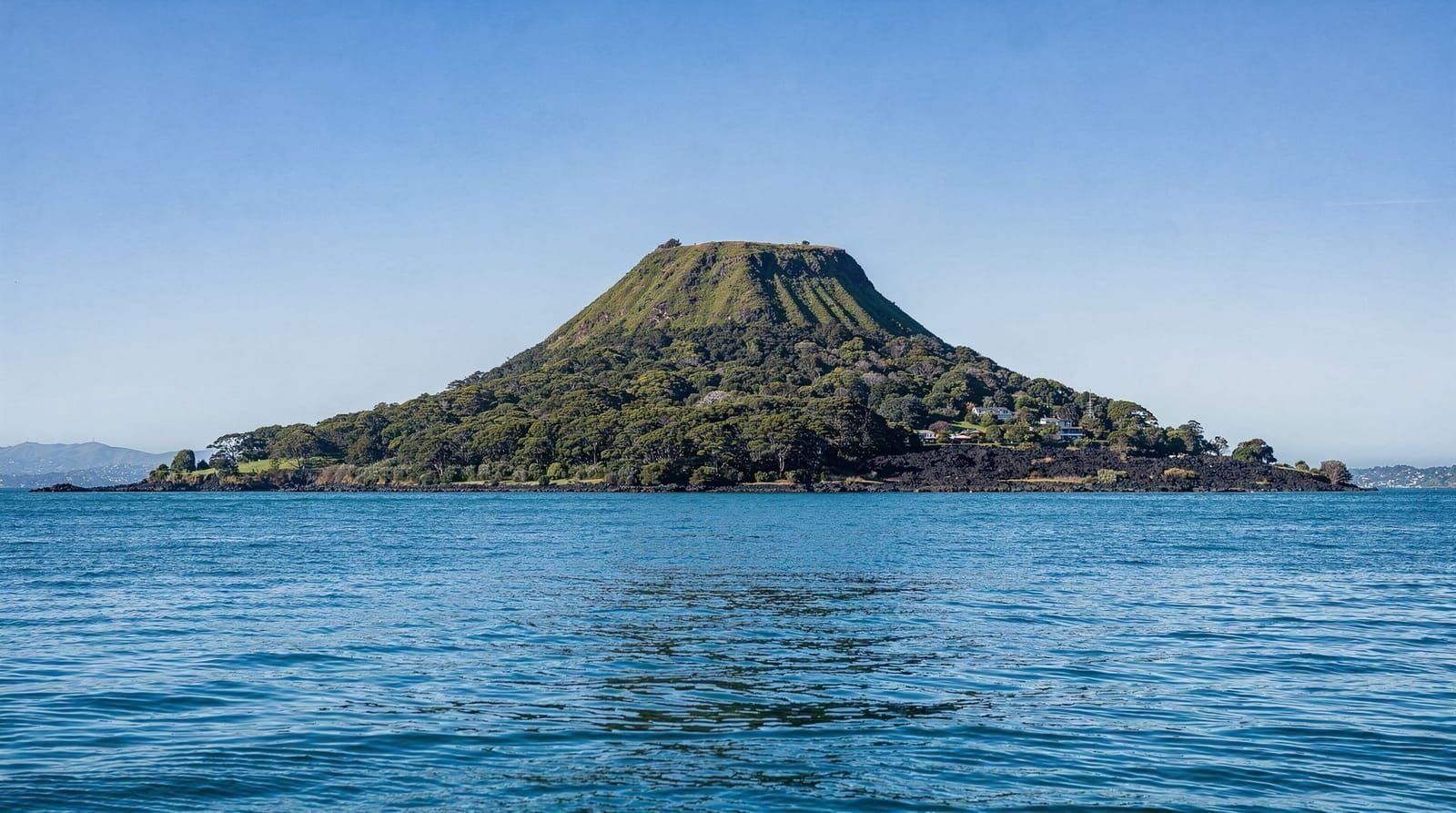
Rangitoto: the youngest cone, and a story grounded in real evidence
Rangitoto Island, the distinctive cone visible from most of Auckland’s eastern beaches and harbourside spots, is the youngest and largest of the volcanic field, and its eruption is unusually well dated for a reason that connects directly to Māori history: archaeological evidence, including preserved footprints found beneath volcanic ash on Rangitoto and neighbouring Motutapu Island, indicates that Māori were present in the area and witnessed the eruption, generally dated to around 600 years ago. That’s a remarkable, evidence-backed link between oral tradition and the physical record — genuinely rare in volcanology anywhere in the world, where eruptions predating written record are usually reconstructed from geology alone rather than corroborated by direct human evidence of the event itself.
It’s one of the more striking facts about Auckland’s landscape, and it’s worth knowing before you take the ferry out to Rangitoto Island or walk to its summit — see our Rangitoto hike guide for the practical details of visiting.
Why a short list of legends isn’t the same as cultural knowledge
It would be easy to pad this article out with specific named legends and dramatic character narratives — that’s the well-worn format for this kind of travel content. We’ve deliberately avoided doing that here. Māori oral tradition includes genuinely rich, specific stories tied to particular places, but many of those stories carry different levels of sensitivity, belong to particular iwi and hapū, and are properly told by the people who hold that knowledge, in the right context, not summarised secondhand in a blog post aimed at tourists. A handful of generalised facts about maunga-as-ancestors or Rūaumoko’s association with volcanic activity gives you useful context for what you’re looking at around Auckland. It does not add up to real cultural understanding, and we’d rather say that plainly than pretend otherwise.
Where to actually learn more, properly
If this has sparked genuine interest rather than just background context for photos, the honest next step is a guided experience led by Māori guides themselves, not a repackaged version of what you’ve just read. A guided Māori cultural experience in Auckland puts you in front of people sharing their own history, language and perspective directly, which is a meaningfully different experience from reading about it. If your schedule allows a stop at Auckland Museum — which sits, fittingly, on the slopes of Maungakiekie — a Māori cultural performance at Auckland Museum combines a live performance of waiata (song) and haka with the museum’s own taonga (treasured artefacts) collection, curated with iwi involvement. Both are considerably better uses of an afternoon than a generic legends recap, and both put money and attention toward the communities whose history this actually is.
If your trip extends to Rotorua, the country’s most developed hub for in-depth Māori cultural tourism, our Rotorua day trip guide, is Rotorua worth it guide and the Rotorua geothermal and Māori cultural tour are worth building into your itinerary — Rotorua’s cultural experiences are generally more extensive than anything available within Auckland itself, reflecting the concentration of iwi-run cultural tourism infrastructure there.
Pā sites and what the terracing on the maunga actually means
If you climb Maungawhau or Maungakiekie and notice the rings of terracing cut into the slopes, that’s not landscaping — it’s the remains of substantial fortified pā settlements, some of the largest in the country before European contact, housing communities of hundreds or more people at their peak. Kumara storage pits, defensive ditches and house terraces are still visible on several of Auckland’s cones if you know what you’re looking at, which is a useful reminder that these maunga were lived-in, defended, contested places for many generations, not simply scenic backdrops that happened to have spiritual significance attached afterward. That combination of the sacred and the strategically practical is a recurring theme across Tāmaki Makaurau’s volcanic field, and it’s part of why so many of the isthmus’s iwi fought over control of these particular hills rather than the flatter land surrounding them.
A closing note on visiting these sites
If you do visit Auckland’s maunga, a few small courtesies go a long way: stick to formed paths (many summits are ecologically sensitive as well as culturally significant), don’t sit on tables used for food at any marae or cultural site you visit, and avoid touching carvings or sacred sites without explicit invitation. None of this requires deep expertise — it’s the same basic respect you’d extend to any sacred or historically significant site anywhere in the world, and it’s genuinely appreciated. See our complete Auckland city guide for how these sites fit into a wider visit, our top Auckland attractions guide for the practical side of visiting the volcanic cones themselves, and our Auckland neighbourhoods guide for how the maunga sit within the wider city.
Frequently asked questions about Understanding Tāmaki Makaurau
What does Tāmaki Makaurau mean?
It’s generally translated as “Tāmaki desired by many,” referencing how strongly the region’s resources — two harbours, fertile volcanic soil and a strategic land bridge — were contested between iwi over centuries.
Why are Auckland’s volcanic cones considered sacred?
They’re widely regarded in Māori tradition as tūpuna maunga, or ancestor mountains, carrying genealogical significance, and many also served as major pā (fortified settlements), giving them both spiritual and historical weight.
Which iwi holds mana whenua over central Auckland today?
Ngāti Whātua is most closely associated with mana whenua over the central Auckland isthmus, though the wider history of Tāmaki Makaurau involves multiple iwi across different periods.
Did Māori really witness the Rangitoto eruption?
Yes — archaeological evidence, including footprints preserved under volcanic ash on Rangitoto and neighbouring Motutapu Island, indicates Māori were present in the area around the time of the eruption, generally dated to roughly 600 years ago.
What’s the best way to learn about Māori culture as a visitor to Auckland?
A guided cultural experience led by Māori guides, or a cultural performance at Auckland Museum, both give you direct, authentic context that a general-interest article like this one can only introduce, not replace.